The Lößnitzgrund
Geography
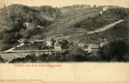
The natural landscape of the Lößnitzgrund lies to the south of Buchholz-Friedewald, is considered the largest valley incision on the Elbe slope of the Lausitzer Platte and forms part of the "Landscape Conservation Area Lößnitz". The Lößnitzbach, which meanders through it, forms this notch valley, which, along with Fiedlergrund and Rietzschkegrund, is one of the valleys in the Radebeul urban area with a high water flow. Geologically, the Lößnitzgrund separates the two main types of soil that can be found in the Lößnitz area alongside the syenite soil on the Lusatian plate: loess, which is found on the eastern slope, and heath sand, which is found on the western slope. Oaks (especially English oaks), copper beeches and hornbeams characterise the tree population; other deciduous trees have taken root in the stream area, and the bird life is also rich in biodiversity.
In the past
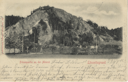
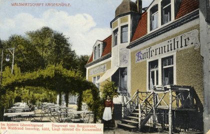
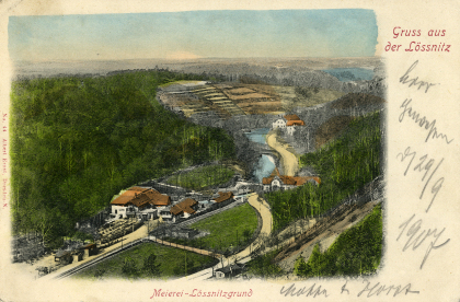
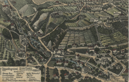
As early as the Middle Ages, the narrow valley, which rises steeply on both sides, was of economic importance as the site of several mills, with the milling trade being one of the oldest trades in the Lößnitz region. For example, the Grundmühle, the Carlowitz or Böhnitzmühle, the Meierei, the Jägermühle, the Schefflermühle and the Kaisermühle were established in the Lößnitzgrund. In the 19th and 20th centuries, several syenite quarries were therefore operated in the Lößnitzgrund and its neighbouring valleys, including the Dorf- and Rieselgrund. The most prominent of these was the so-called Hohe Stein above the power station built in 1895. The so-called Todhübel (222.5 metres above sea level) rises steeply on the eastern slope to the south of the village. A man-made ditch several metres deep and scattered shard finds (14th/15th century) suggest that there may have been a medieval fortification here, despite the lack of building remains.
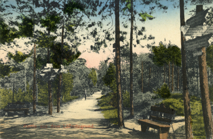
The hiking trails laid out from 1880 by the "Verschönerungsverein für die Lößnitz" gave the starting signal for the establishment of the Lößnitzgrund as one of the most popular excursion destinations for Lößnitz residents and their neighbours in the Dresden or Moritzburg region. A short time later, the narrow-gauge railway built in 1883/84 made this local recreation area easily accessible for visitors, and the "Lößnitzdackel" still connects the two railway stations of Radeburg and Radebeul Ost today. The shady trees and the lively gurgling of the Lößnitzbach stream were not only enjoyed here by the heat-stricken guests of the Bilz baths built in 1905. The former mills were transformed into favoured excursion inns for sociable music and dancing as well as culinary delights. The classic walk leads from the Grundmühle via the Flora fruit wine tavern, the Meierei and the Kurhaus Friedewald to the Kaisermühle. However, the area also offers hiking enthusiasts delightful opportunities for a relaxing excursion in the realm of nature. The section of the nature trail from Radebeul-Lindenau through the Lößnitzgrund, which was signposted in 1973, was renovated in 1992/94 by pupils of the grammar school "Luisenstift". Other popular hiking routes include the Schluchtenweg to Oberkötzschenbroda, the Dreizehn-Brücken-Weg to Lindenau, which runs along the Lindenaubach stream, or through the water-rich Rieselgrund (historically also known as Riesengrund or Rosengrund), whose piped springs were used for centuries to irrigate the Lößnitz vineyards, to Wahnsdorf. Most recently, in 2016, on the initiative of the Bilz Association, the Bilz circular trail leading partly through the Lößnitzgrund was redesigned to invite hikers to experience light, air and water in the Bilz sense. Even today, visitors appreciate the cool, calm and relaxing surroundings of the Lößnitzgrund for refreshment and relaxation.
(Source: Radebeul town archives)
